

In this article, VietFlycam would like to share with readers basic information about drone equipment as well as unmanned drone applications for topographic mapping.
Mục lục
What is Flycam?
Flycam, also known as drone, unmanned aerial vehicle, UAV (Unmanned Aerial Vehicles) is a flying device that does not need a pilot in the cockpit, instead, this device is controlled by a person standing below the surface. land or follow a pre-programmed flight path.
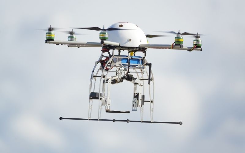
Flycam or UAV technology is widely applied in many different fields because it brings many benefits, contributing to improving productivity or work efficiency.
Agriculture
Application of UAV in agriculture supports digital farmers in seeding and crop care. The UAV device has the ability to fly high, integrates plant parameters from which it is applied to distribute fertilizers, automatically regulates the appropriate amount of chemicals, sprays pesticides, and provides images of the current status of crops. .
Farmers in the 4.0 era can avoid toxic chemicals, observe plants and give appropriate care plans. In addition, the images of plants can be used in communication activities about clean vegetable products using UAV – high-tech techniques in planting and tending.
Military defense
UAVs can now take on an offensive role in high-risk missions such as suicide attacks, bomb and missile attacks, destruction or interception of air defense systems, links or entire systems. enemy communications systems, tactical air reconnaissance of the battlefield as well as conducting search and rescue missions. In addition, they can monitor from above to help protect security optimally, fight pirates, act as target targets for weapons systems on the ground and in the air…
Media Arts
UAV (Drone/Flycam) is widely used in movies and art because of its excellent digital image quality, bringing eye-catching scenes to viewers.
Construction geodesy
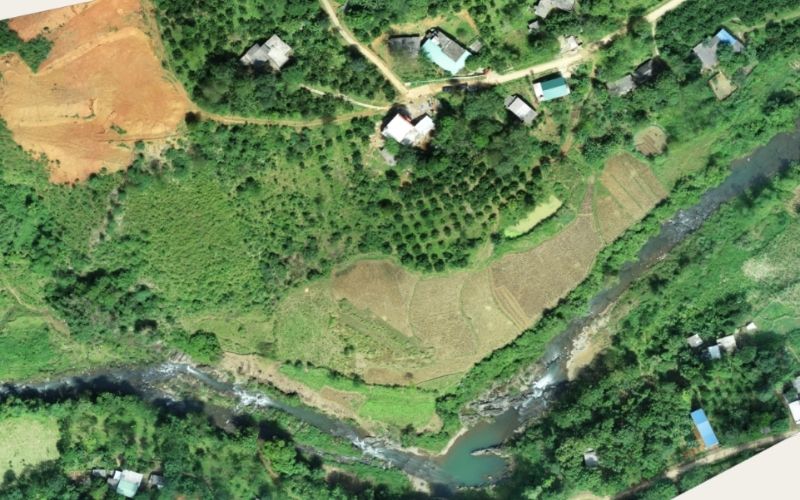
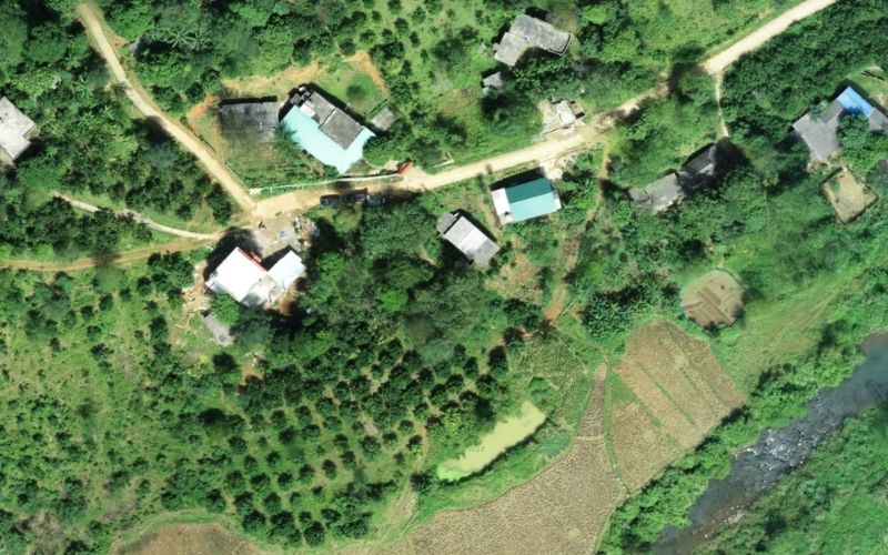
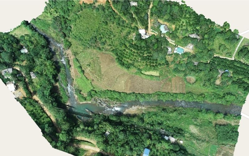
Unmanned aerial camera serves to create topographic maps extremely effectively, saving time and surveying costs much more than traditional survey methods, UAVs are used in the construction field for the following purposes: surveying. digital surveying, flying terrain scanning, mapping, creating 3D models for the area. In addition, UAV is also used to monitor the construction progress of the works.
Application of unmanned drones for topographic mapping
Create 2D maps
The UAV is controlled to capture images of the surveyed area from above. From the data obtained after the scanning process, a 2D map is obtained to help users have the most comprehensive overview of the area’s topography.
From the 2D map, users can easily calculate the area, measure the length of the object online by simply clicking, dragging and dropping the mouse on the data storage system.
Create intelligent 3D models
In addition to creating 2D maps, UAVs (Drone/Flycam) can also provide data, create 3D models for the area, provide a more multi-dimensional view, and can calculate the volume and measure the angle of objects easily. .
Create a VR360 image in the air
Not only providing a 2-dimensional, 3-dimensional view when surveying terrain and areas, UAV (Drone/Flycam) also offers a 360-degree view, VR 360 image is one of the extremely innovative applications of UAV.
VietFlycam terrain scanning flight service
Viet-Flycam is a unit specializing in providing VietFlycam-related services, including topographic surveying, 2D mapping, and 3D modeling services. The unit was established in August 2017, up to now, it has had more than 4 years of establishment and development in the field of drone solutions.
The service Vietflycam provides focuses on quality and customer experience. The biggest difference of VietFlycam compared to competitors is the process of researching and developing technology ideas, exploiting customer needs, forming the research and testing process. Since then, VietFlycam has launched high-tech products to solve the deep problems of the operation process.
Giải pháp máy bay không người lái Việt-Flycam
Hotline: 0917.111.392 - 0869.191.996
Địa chỉ: Tòa nhà D8, Đại học Bách Khoa Hà Nội, Trần Đại Nghĩa, Hà Nội, Việt Nam
Email: Vietflycam1102@gmail.com
Youtube: https://www.youtube.com/channel/UCgRFxKxd2vt5gn_mbS1sJgA