

Welcome! Are you looking for a digital geodetic data management solution?
Digital data storage and display platform
- Vietnam Flycam provides services for storing, processing, and displaying digital geodetic data.
- The only online map data display software system deployed in Vietnam
- Technology automatically processes raw data: image centre, drone image, GCP, PPK points, etc., into geodetic products: 2D geodetic map, 3D model, VR 360 image, accurately and fast.
BASIC
100.000đ
month
100MB - 10GB data capacity
Premium
1.500.000đ
month
10GB - 100GB data capacity
Business
6.000.000đ
Month
100GB - 500GB data capacity
Enterprise
10.000.000đ
month
500GB -1T data capacity
only 99.000vnd/GB INPUT FOR THE SAME PRICE DATA PROCESSING PACKAGE
SERVICE
How does the software work?
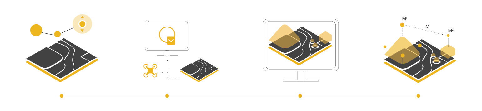
Fly over the map and scan it
Look for country landmarks.
Searching for national landmarks and elevations to establish a control grid connecting the work to the national coordinate system. The network of coordinates and national elevation on the storage system is spread throughout the territory, ensuring the density within 5–15 km2 will have 1 coordinate point, and 5–10 km2 will have 1 national elevation point.
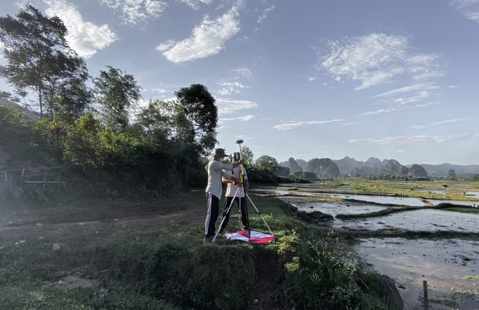
Determine the number of GCP points required.
Determination of ground control points (GCP) is the process of marking large targets on the ground, spaced throughout the entire area to be surveyed.
GPS coordinates are important for map accuracy, ensuring that the latitude and longitude of any point on the map correspond exactly to the actual GPS coordinates.
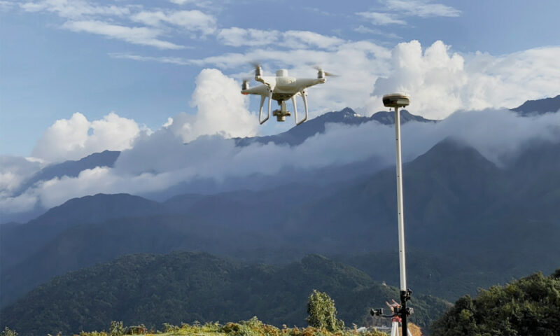
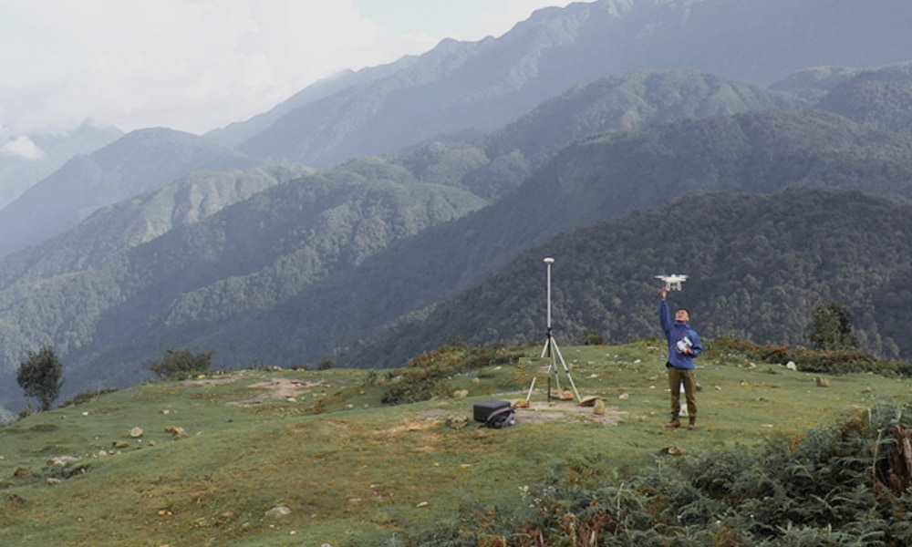
UAV equipment is used to conduct scanning flights.
Using a drone that scans the entire area in 2D and 3D speeds up implementation five times compared to ground-based methods and requires less manpower by automatically collecting and analyzing data. Data is automatically synchronized online, allowing easy monitoring of the survey process to ensure objectivity and accuracy.
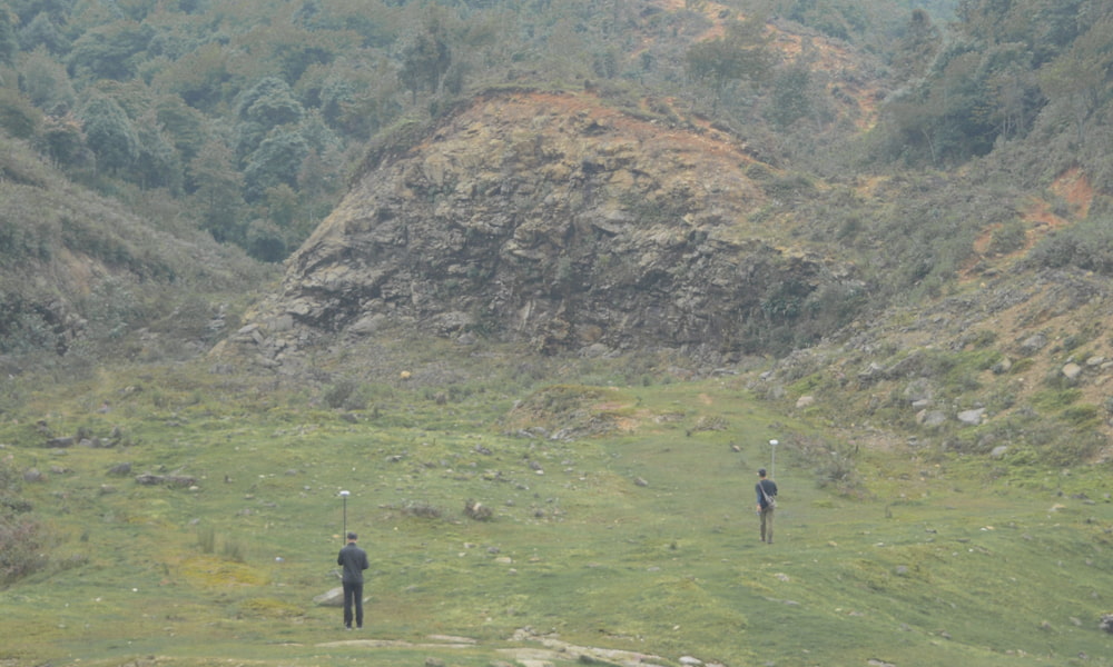
Additional locations that cannot be surveyed by aircraft are measured.
For the hidden points where the drone cannot collect images, the survey team conducts additional measurements. The image simulates the detailed scanning area of each object, accurately from all angles, topographical and topographic features of the survey area, showing in detail the topography of the area and the features located in that area, including houses, trees, power lines, structures, etc.
Collecting data
Previous
Next
- To access dulieu.autotimelapse.com click here. If you don’t have an account, create one
- To start a new project, click “Add Project.”
- In the “Input” section, upload files under the correct heading
Processing of data
- Register to process the required data: 2D, 3D, VR360, update maps for raw data to be entered into the system, and automatically process data
- Save the processed data to the “Output” folder.
Display data
Previous
Next
Raw data is entered into the system and processed automatically
- Creating two-dimensional and three-dimensional visual maps of the scanned flying area
- Create scale maps and current status maps to analyze the survey region visually.
- Measurement and calculation of the complete survey area online using the input data source
- Compare data from each survey to provide investors a better understanding of the construction process.
service
Comparing Traditional Methods and Vietnam-Flycam Solutions
Traditional challenges in the management of geodetic data and technical drawings
- 01 Technical drawings require very high configurations computer.
- 02 It takes a long time with drawings manually.
- 03 Lot of storage and manual work on documents.
- 04 The slow and inconvenient data sharing process.
- 05 Low accuracy level. It is difficult to avoid errors.
The Utilities of Viet-flycam's digital data storage and display platform
- Automatically convert raw data (measurement data) into 2D and 3D maps and technical drawings.
- Saving time by being quick, efficient, and cost-effective.
- Online storage, mapping, and measurement software tools are integrated on app and web platforms for easy use on mobile devices: phones, tablets.
- Share data with customer partners easily with simple and convenient operations.
- Reduce manipulation errors, improve objectivity, and boost dependability.
service
WHY CHOOSE US?
Friendly user interface
User-friendly interface, easy to use and perform image import, processing, and display options of geodetic data.
Massive data storage with lightning-fast data processing
Unlimited data storage capacity and fast processing speed reduce waiting time between surveying and digital rendering processes. The system runs reconstruction tasks using multiple graphics cards simultaneously, improving work efficiency.
Geodetic standards are focused right from the start.
Maximize the accuracy of output data by strictly setting the inputs required for geodetic data processing: a ground control point (GCP), PPK, checkpoint, photo centre,...
Personalize the user experience.
Personalize the customer experience with security and independent information handling. From input raw data (Input), through automatic processing, products (Output) are created to meet all the geodetic survey needs of each customer flexibly.
High productivity at a low cost
Up to a fivefold increase in efficiency and a 50% reduction in geodetic costs. Fly and scan. Flycam with a large area
Through optimal communication solutions, technologies, and services, Viet-Flycam wishes to create quality products, contributing to promoting the image of the country and the people of Vietnam to the world.
CONTACT
subscribe
Copyright © 2024 Viet-Flycam byI&I Hitech. All Rights Reserved.