
Taking on the Son Tra – Da Nang Project, VietFlycam utilizes advanced LiDAR scanning technology to deliver highly accurate, detailed, and comprehensive 2D and 3D maps. This technology effectively filters out vegetation layers, ensuring precise elevation measurements of the terrain surface.
Mục lục
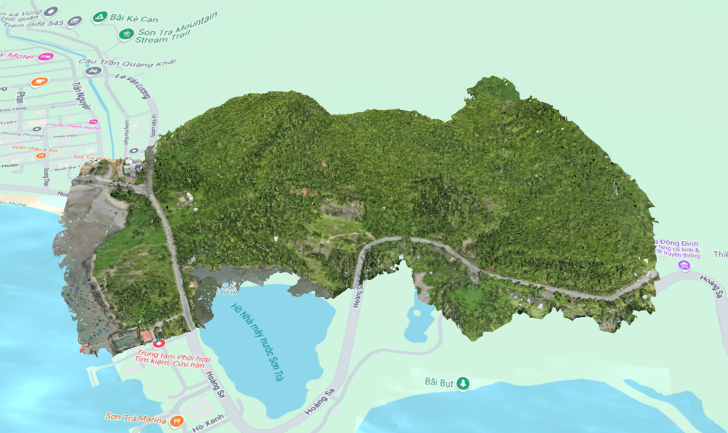
Topographic Survey of the Son Tra – Da Nang Project
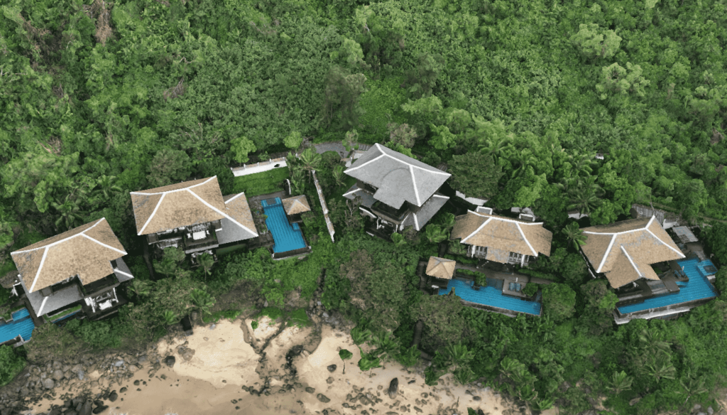
Located 10 km northeast of Da Nang city center, the Son Tra Project features coastal terrain, mountainous landscapes, and dense forests, forming a diverse and complex topographical system.
By applying LiDAR Scan technology, VietFlycam can remove vegetation layers, providing precise elevation data for terrain analysis. This helps engineers clearly visualize the site and develop optimal design solutions for the project.
Comprehensive Geodetic Survey Package for Urban Planning
Using LiDAR scan data, VietFlycam processes and delivers 2D & 3D maps along with detailed topographic drawings. These serve as essential tools for architects, engineers, and planners to enhance the accuracy of construction and planning processes.
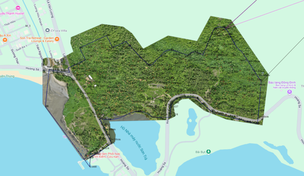
2D Maps
High-resolution, visually detailed 2D imagery with comprehensive object statistics.
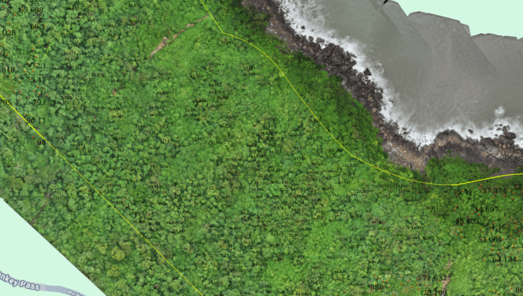
Detailed 1/500 Topographic Drawings
Highly accurate 1/500-scale topographic maps with precise contour lines. Tree inventory, including tree count, root diameter measurement, and classification by survey area.
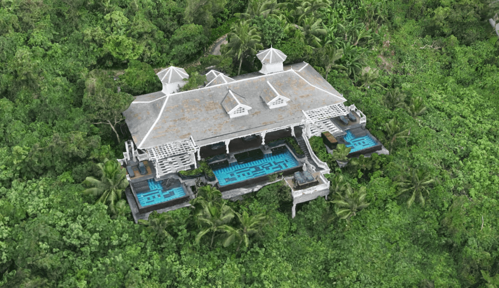
3D Models
High-density 3D Point Cloud models, ensuring maximum precision in terrain representation.
VietFlycam – The Leading Provider of Geodetic Survey Solutions
VietFlycam’s flycam-based topographic survey services offer a professional and reliable solution for site assessment and construction planning. With the capability to survey vast areas ranging from tens to hundreds of thousands of hectares, we are committed to meeting all data processing and project timeline requirements.
By combining cutting-edge technology with extensive UAV survey experience, we collect data to generate highly accurate, visually dynamic 3D models.
Our Survey Workflow Includes:
- Data Collection, Processing, Visualization & Online Storage: UAV-collected data is processed into accurate geodetic information, accessible online for easy tracking and management.
- Mapping, Measurement, and Calculation: Utilizing advanced technology, we perform precise measurements and map editing, ensuring objective and reliable topographic parameters.
- Geodetic Data Sharing & Security: Securely share survey data with partners and clients, with access control features to maintain data integrity and confidentiality.
- 2D & 3D Model Creation: Automatically processed 2D & 3D models from aerial survey data, offering detailed topographic and environmental insights. Customized scale maps (1/500, 1/2000, 1/5000), cadastral maps, and survey products for urban planning, terrain assessment, land clearance, and construction projects.
With a strong commitment to excellence, VietFlycam is your trusted partner in topographic surveying and geospatial analysis.
Giải pháp máy bay không người lái Việt-Flycam
Hotline: 0917.111.392 - 0869.191.996
Địa chỉ: Tòa nhà D8, Đại học Bách Khoa Hà Nội, Trần Đại Nghĩa, Hà Nội, Việt Nam
Email: Vietflycam1102@gmail.com
Youtube: https://www.youtube.com/channel/UCgRFxKxd2vt5gn_mbS1sJgA