
Taking on the Bai Xep – Phu Yen Project, VietFlycam utilizes advanced drone technology to generate accurate and detailed 2D and 3D maps, as well as precise 1/500-scale topographic drawings.
Mục lục
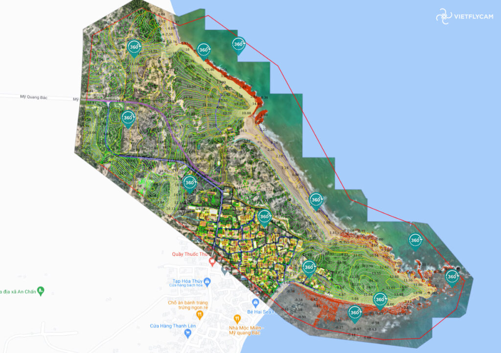
Detailed 1/500 Topographic Survey of the Bai Xep – Phu Yen Project
As a coastal province with strong real estate development potential, Phu Yen has attracted numerous large-scale investment projects. VietFlycam is honored to be entrusted with the topographic survey of this site, providing essential data for status assessment, evaluation, and construction planning.
Comprehensive Geodetic Survey Package for Construction Design
VietFlycam’s topographic survey package offers a complete solution for clients needing status evaluation, site assessment, and project design for real estate development and investment.
With innovative technology, this cost-effective solution helps clients save time and resources. Backed by high-precision data and experience from surveying hundreds of projects both locally and internationally, VietFlycam is committed to delivering the highest quality service at every stage of project development.
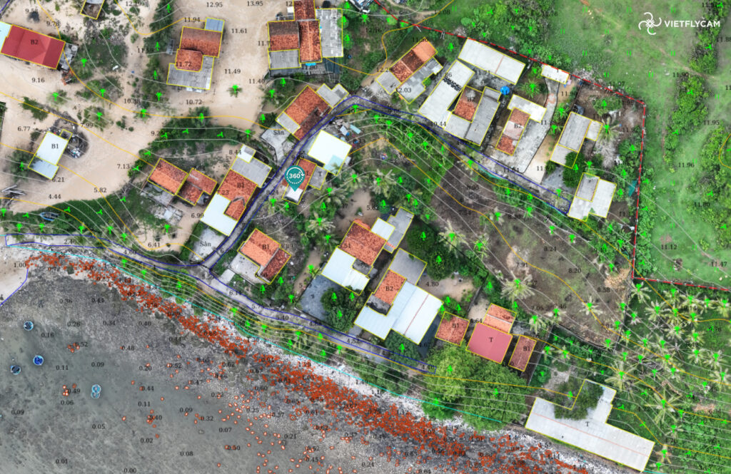
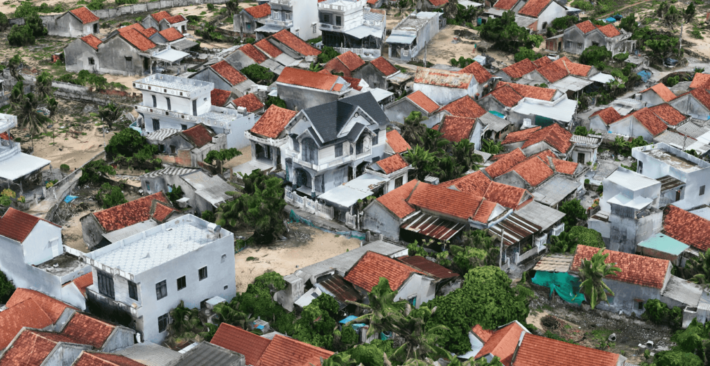
2D Maps
High-resolution imagery for object inventory, tree and rock measurements, land boundary verification, and building & road dimension analysis.
Detailed 1/500 Topographic Drawings
Used for measurement, design, leveling, excavation calculations, and planning submissions.
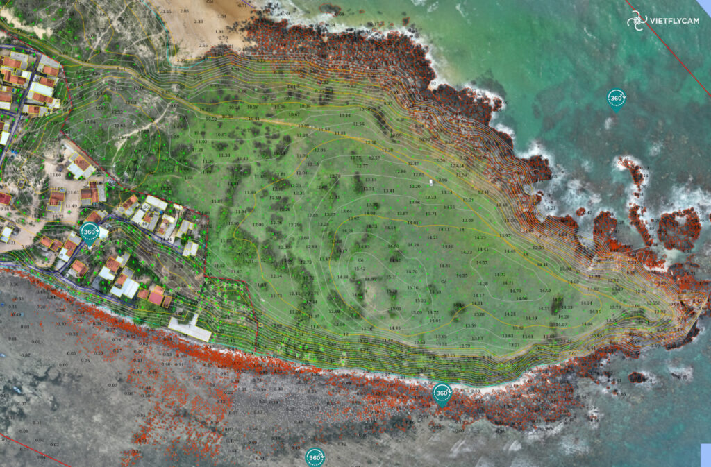
3D Models
Provides detailed height measurements of objects on the map. Enables architects to overlay designs directly onto the scanned 3D terrain model.
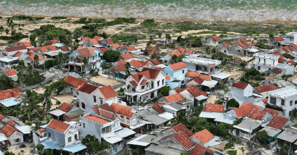
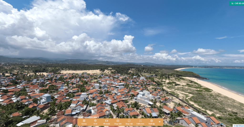
VR 360 Panoramic View
Videos and images for marketing, communications, and project data archiving.
VietFlycam – The Leading Provider of UAV-Based Topographic Survey Solutions
As a pioneer in UAV technology for geodetic surveys and mapping, VietFlycam is equipped with a highly skilled team and state-of-the-art technology, ensuring high-quality deliverables tailored to meet client needs.
Our Mapping Services Include:
- 1/500, 1/2000, and 1/5000-scale topographic map production
- Current status mapping for urban planning, land management, and environmental research
- Map digitization and real-time 2D & 3D visualization for accurate site assessment
- Detailed topographic map editing for official evaluation and approval by regulatory authorities
If you need a topographic survey and mapping services, contact VietFlycam today for expert consultation and a detailed quotation!
Giải pháp máy bay không người lái Việt-Flycam
Hotline: 0917.111.392 - 0869.191.996
Địa chỉ: Tòa nhà D8, Đại học Bách Khoa Hà Nội, Trần Đại Nghĩa, Hà Nội, Việt Nam
Email: Vietflycam1102@gmail.com
Youtube: https://www.youtube.com/channel/UCgRFxKxd2vt5gn_mbS1sJgA