
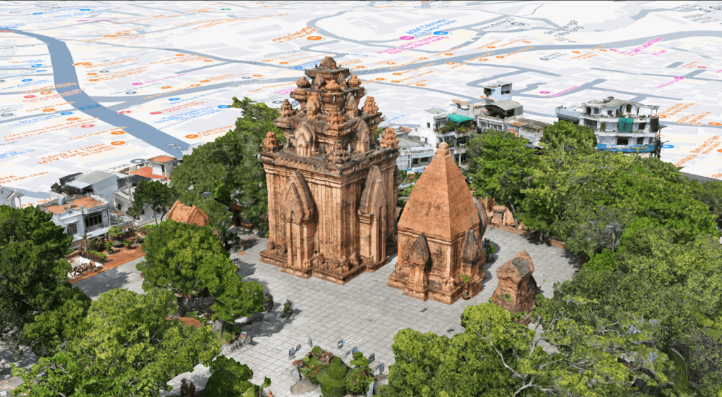
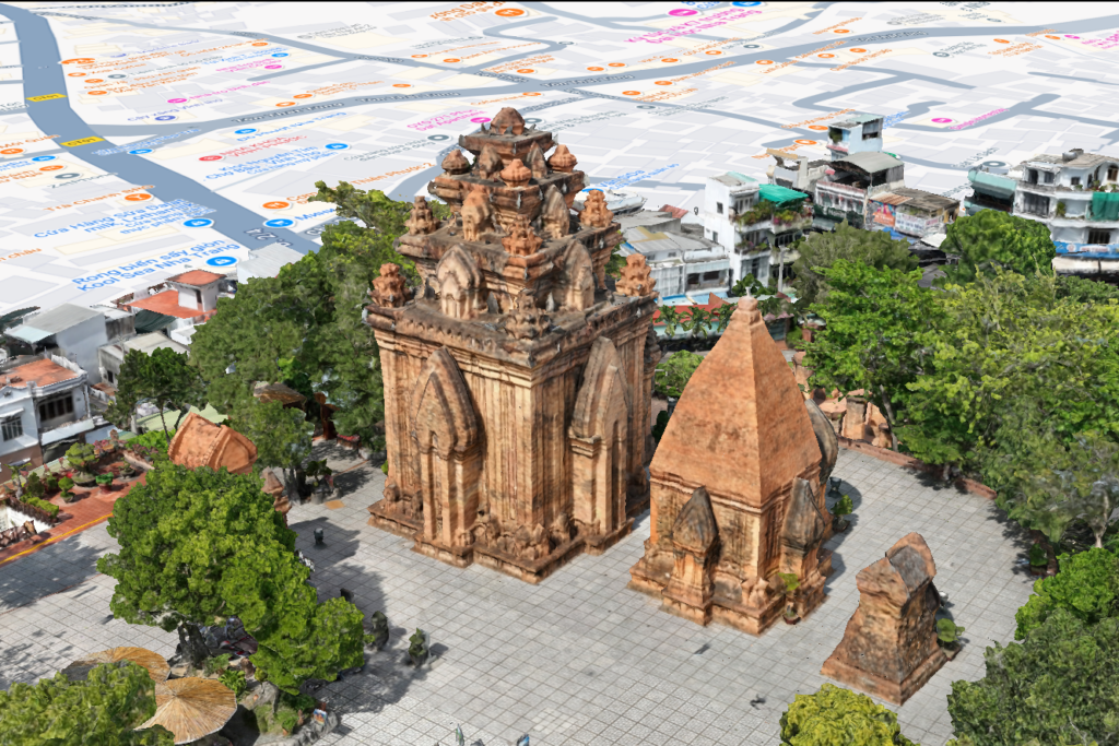
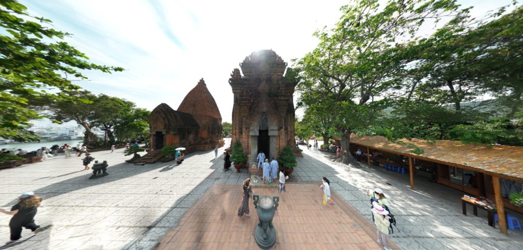
The Ponagar Tower in Nha Trang is a special architectural complex of great cultural and historical value that marks a prosperous period of Hinduism development. Viet-Flycam provides professional 3D scanning services of the current state, offering comprehensive solutions for the preservation and development of historical relics.
Mục lục
- 1 Survey of the topography of the Ponagar Tower archaeological site in Nha Trang
- 2 3D scanning of Ponagar Tower for renovation and conservation purposes
- 3 Comprehensive geospatial surveying package at VietFlycam
- 4 Viet-Flycam – A professional provider of topographic survey services using unmanned aerial vehicles (drones)
Survey of the topography of the Ponagar Tower archaeological site in Nha Trang
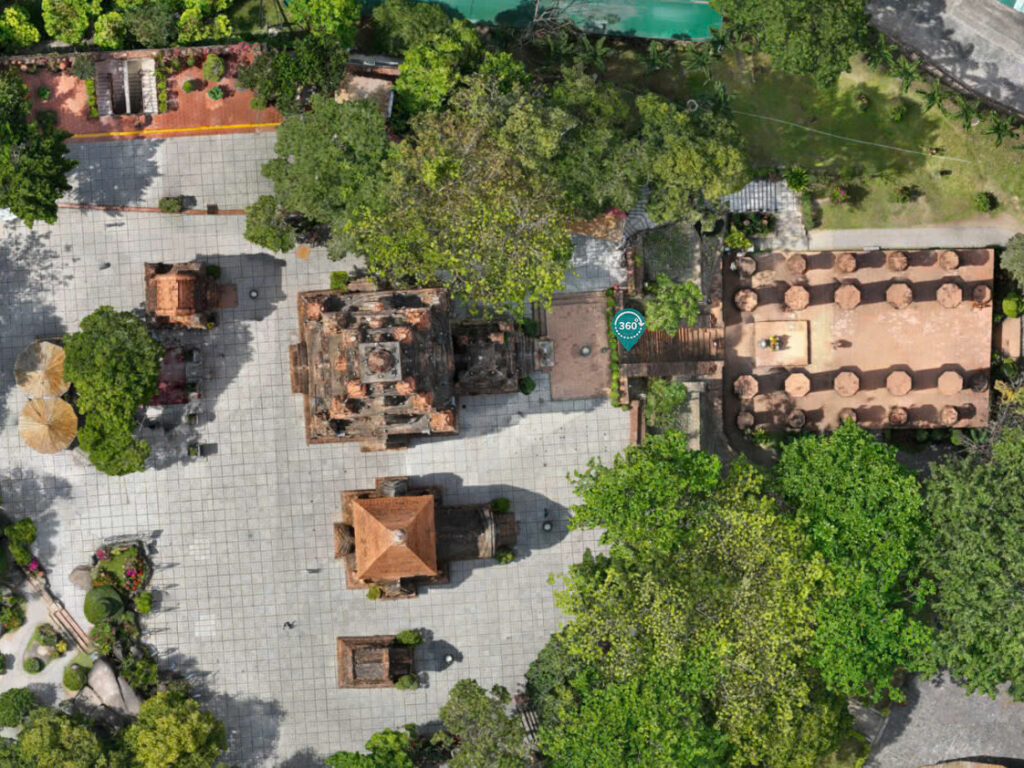
Ponagar Tower is a large architectural complex consisting of three main parts: the Gate Tower, Mandapa, and the Temple area. After thousands of years of historical changes, the archaeological site now only retains five architectural structures on two levels: the Mandapa (the front hall area where the Cham people prepare offerings before presenting them) and the Temple area above.
3D scanning of Ponagar Tower for renovation and conservation purposes
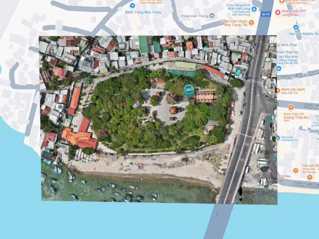
With extensive experience in implementing various survey and renovation projects of historical relics, Vietflycam provides 3D scanning services and in-depth topographic surveys. Advanced technology ensures precision down to the smallest detail, offering comprehensive solutions for the conservation and development of precious heritage sites.
For the survey of the Ponagar Tower project, VietFlycam utilizes modern 3D scanning technology to create the most accurate, detailed, and comprehensive 2D and 3D maps.
– Creation of precise 2D maps and visual 3D models of the current state
– Detailed scale drawings at 1/500 scale
– Online measurement and calculation
– Rapid renovation and reconstruction services
– Digitization of historical relics for virtual tourism. Experience virtual reality (VR360)
– Utilization of 3D printing technology to create accurate physical models from scan data
Comprehensive geospatial surveying package at VietFlycam
Survey for 2D drawing creation
Survey for 3D drawing creation
Topographic map at 1:500 scale

VR360
Viet-Flycam – A professional provider of topographic survey services using unmanned aerial vehicles (drones)
Viet-Flycam is a leading provider that integrates modern drone technology into topographic surveys, accompanying numerous projects involving the survey and renovation of historical relics, converting physical objects into highly accurate digital models (with a margin of error of 2mm).
Viet-Flycam offers comprehensive drone solutions:
- Real-time data collection, processing, display, and storage of geospatial data
- Measurement, calculation, and editing of maps with simple operations to ensure the accuracy and objectivity of terrain parameters
- Sharing geospatial data with partners and clients. Data security is ensured through access control and editing restrictions
- Automatically processing scan data into 2D and 3D models; scale maps at 1/500, 1/2000, 1/5000; cadastral maps and products for planning, clearance, filling, topographic surveys, etc.
Giải pháp máy bay không người lái Việt-Flycam
Hotline: 0917.111.392 - 0869.191.996
Địa chỉ: Tòa nhà D8, Đại học Bách Khoa Hà Nội, Trần Đại Nghĩa, Hà Nội, Việt Nam
Email: Vietflycam1102@gmail.com
Youtube: https://www.youtube.com/channel/UCgRFxKxd2vt5gn_mbS1sJgA